Showing posts with label The Beauty Of Indonesia. Show all posts

BOROBUDUR TEMPLE

You ever visit Borobudur Temple? This Buddhist temple has 1460 relief panels and 504 Buddha effigies in the complex. Millions of people are eager to visit the buildings that are included in this World Wonder Heritages. Not surprising, since both architecturally its function as a place of worship, Borobudur is indeed Captivate hearts.

Borobudur was built by King Samaratungga, one of the Kings of old Mataram Kingdom, the descendant of sailendra dynasty. Based on the inscription Kayumwungan, an Indonesia named Hudaya Kandahjaya revealed that Borobudur is a place of worship which was completed may 26, 824, almost one hundred years since the beginning of construction. The name Borobudur itself according to some people means a mountain having terraces (budhara), while some others say that Borobudur means Monastery located in high places.

Borobudur building shaped stairs constructed consists of 10 floors. Height 42 yards before being renovated and 34.5 meters after renovated due to the level of the lowest used as anchoring. The lowest six levels of square shape and three floors above a circular and one of the highest levels in the form of Buddhist stupas facing westward. Each terrace symbolizes the stages of human life. According to the Mahayana Buddhist school, every person who wants to reach the level of the Buddha must be through every level of life.

The base of Borobudur, called Kamadhatu, symbolizes the human beings who are still bound to lust. The four levels on it called Rupadhatu symbolizing human beings who have been able to break free from lust but still bound to appearance and shape. At that level, Buddha statues are placed face up. Meanwhile, three levels above it where the Buddha placed inside the stupa with wholes are called Arupadhatu, symbolizing humans who have been freed from lust, form, and shape. The top part is called Arupa symbolizes Nirvana, the Buddha is residing.

Each terrace has beautiful reliefs that show how skillful the sculptors. The Relief is to be read in order when you walk clockwise (towards the left from the entrance of the Temple). Borobudur relief tells the story of a very legendary story of Ramayana. In addition, there is also a relief depicting the condition of society at that time. For example, the relief of the activity of the farmer who reflects on the progress of current farming systems and the relief of the sailing ship is a representation of the progress of the voyage at that time based in Bergotta (Semarang).

The overall relief panels in Borobudur Temple reflect Buddha's teachings. Therefore, it can be educational media for people who want to learn the teachings of the Buddha. YogYES invites you to surround each narrow passage in Borobudur in order to understand the philosophy of Buddhism. Atisha, a Buddhist from India in the 10th century, has never been to the temple which was built 3 centuries before Angkor Wat in Cambodia and four centuries before the great Cathedrals in Europe.

Thanks to visit Borobudur and armed with scripts from Serlingpa Buddhist teachings (one of the King of Srivijaya), he was able to develop the teaching of Buddha. He became Abbot of Vikramasila and taught Tibetans of practicing the Dharma. Six scripts from Serlingpa were summarized into a core teaching called "The Lamp for the Path to Enlightenment" or better known as Bodhipathapradipa.

One of the questions still unanswered about now is how the condition around the Temple when it was built and why the temple was found in the buried. Some say that Borobudur initially stood framed by swamp then buried due to the eruption of the Merapi. Essence is the inscription that reads ' Calcutta Amawa ' means the ocean of milk. That Word is then defined as the lava of Merapi. Some others say that Borobudur was buried by cold lava of Merapi.

With all its greatness and mystery that is reasonable, when many people from all the existing world put Borobudur as a place that should be visited in his lifetime. In addition to enjoying the temple, you can walk around to the villages around Borobudur Temple, such as Karanganyar and Wanurejo to view the activity of citizens making crafts. You can also go to the top of Kendil stone is to be able to view the panorama from the top of Borobudur. Wait for what again? No need to worry about the earthquake on 27 May 2006, due to the Borobudur was not affected at all.

BOROBUDUR AND THE LEGACY OF PROPHETIC FIGURES
The past is indeed full of mystery. Many people believe that the Temple of Borobudur as relics of Syailendra dynasty in the 8th century AD. But it was disputed by KH. Fahmi Basya. This Islamic mathematician believes that Borobudur is very closely related to the history of Prophet Sulaiman. Borobudur is the remains of the Queen of Saba ' as told in the Quran.
 
 This book is not the work of a day two days are arranged. This article was written very seriously for decades; Since 1979 until 2012. In this book the author explains in great detail and scientific evidence that Borobudur is the remains of the Queen of Saba '. There are 40 exact evidence explained. One of the most powerful and yet evidence can be disputed is the discovery of a letter from the Prophet Sulaiman says "Bismilllahirrahmanirrahim" on top of a gold plate inside the bathing pool Queen of Saba ' (Ratu Boko) in Sleman, Central Java.

Lake Segara Anak (children of sea Lake) and the smaller cone volcano is Mount Baru Jari that has developed several hundred years ago

Lake Segara Anak (children of sea Lake) and the smaller cone volcano is Mount Baru Jari that has developed several hundred years ago
Souce of pic in here
Segara Anak is a lake located in the caldera of Mount Rinjani, SembalunLawang  village of Lombok regions, West Nusa Tenggara. Segara (sea) anak means a child of the sea in believe as part of the sea split into an island. It is based on the color blue as the sea water. The Lake lies at an altitude of approximately 2000 mdpl. If you climb Mount Rinjani (3726 Mdpl), generally the Tour Guide will take you across the Lake and spend the night there.

A lot of interesting things that can be done in this Lake. In the Lake there are many fish are fish tilapia, oreochromis mossambicus, and mas. These fish are deliberately dikembangbiakkan by the Government and local communities to increase the attraction of Lake segara anak. Do not forget to prepare equipments for those of you who want to climb Mount Rinjani.

The climbers a lot that makes mount Rinjani trekking trails with spectacular valleys along the Lake to give offerings to the gods of didasar Lake. From the Lake looks a mountain volcano (Gunung means mountain finger New incipient) who is the son of Mount rinjani and nearby there are hot springs which are believed to be able to treat a variety of skin diseases.

In the area of the camp near Lake segara Anak there is an old tree that is sacred to the local population. With the provider of this tree believed that what we want can be answered. Myths that developed in the local community that if you have desires that haven't gotten around to making a wish then gantungkanlah a rock on this tree and then say you desire. If your desire is achieved, then the stones you hang the earlier should be immediately released. According to local people, if you do not return the stone of desire you've achieved will be back somewhere where missing.

The view across the Lake it is amazing and very beautiful so many travelers outside as well as within the country to arrive and climb Mount Rinjani to witness to the indahan Lake. Lake Segara Anak the breadth of 1,100 ha with a depth of 230 m.
 
Hike to Lake Segara Anak Mount Rinjani, Lombok
source pic from here
From hotel in senggigi Lombok to go to Senaru village, you will experience a challenging trip about 7 hours to Senaru through rain forest jungle, along the way you might get to see a variety of wildlife in the serkitar forest. Spend the night in the Crater Rim Senaru Rinjani (you can set up tents on the crater Rim Senaru first)

You can enjoy the view while taking a picture at Rim Senaru I, while preparing ourselves to go down to the Lake which takes 2 hours, upon arrival at the Lake you can relax by wandering around the Lake, a hot bath or fishing around the Lake. Staying on the edge of Lake Segara Anak.

In the morning the next day while enjoying the Sunrise you back to Senaru village. Approximately 12 hours during the day, you will arrive at the village of Senaru and before 5 pm, you will arrive at hotel in senggigi.
 
Mount Rinjani National Park Island of Lombok is the famous volcano with an altitude ascent to 3726 m above sea level and is the second highest volcano in Indonesia, the mountain attracts thousands of climbers every year. A large crater near the top contains a beautiful Lake, Lake Segara Anak (children of sea Lake) and the smaller cone volcano is Mount Baru Jari that has developed several hundred years ago.
 
Sources :
http://id.wikipedia.org/wiki/Segara_Anak
http://www.lomboktravelagent.com/mendaki-ke-danau-rinjani-3-hari.htm


Beautiful views at Karangkates tours

Beautiful views at Karangkates tours >>>>>>>It is a view that can be enjoyed when we were at Karangkates attractions. Karangkates is a recreational area in the South, the Poor village of Sumberpucung sub-district Karangkates Malang. These sights are located in the middle of travel between Malang-Blitar, distance from the town of Malang, about 25 kilometers from the town of Blitar, while about 20 kilometers.

On this occasion appears pretty views at Karangkates tours in the photos that were recently acquired.


 a view towards the West

 a view towards the South

 Generator Power Plant

 The place of "Batu Tumpang" The Overlapping Stones

 
a panoramic view of the surface the Brantas River
 
 
Such beautiful scenery photos at Karangkates tours, if you need any help, I am ready to help. You can contact me through my Facebook here. KLIK

I Love Indonesia because of the panoramic view of Mount Bromo

I love Indonesia because of its attractiveness and beauty of nature Bromo it. Although including the active volcano, but thousands of tourists both local and foreign tourists often come up to a volcano with an elevation of 2.392 meters above sea level. Bromo volcano is located in the village of Ngadisari, Probolinggo, East Java. BROMO itself derived from the Sanskrit "...BRAHMA ... ", the principal deity in Hindu Mythology as the God of creation. Geologically, the formation of Mount Bromo and the famous Sands Ocean starting from the existence of the Tengger Mountains, an old Volcano that formed about a million years ago and is the Largest and the highest Mountain on the island of Java with an elevation ranging from 4000 meters. history of the formation of the plateau and Tengger in summary as follows. Tengger volcano is active and mounting a small eruption which throws a number of volcanic material forms a large Valley to the Southeast and in to the village Cow Kerep. Tengger Volcano erupted then and it is making the caldera in diameter over 8 kilometers. The volcanic eruption of advanced material accumulated inside the caldera is wide and deep.

"...The Ocean Sand Mountain Bromo ... "


The caldera is now a sea of sand and volcanic activity continued into the accumulated mountain – a mountain just inside the tengger caldera. Among other things, the mountain Watangan Mountain Widodaren, Mountain Seat, Batok Volcano and mount Bromo. Sea of sand surrounded by a very steep cliff of the caldera with a slope of approximately 60-80 degrees and height ranges from 200-600 meters.There are about 7 mountains that surround the tengger Caldera, with the highest mountain is g. Penanjakan (2770 m above sea level), in Pananjankan this is a favorite location for local tourists and foreign tourists to catch mount Bromo and the Batok Volcano in the background mount Semeru, the highest mountain on the island of Java. Bromo crater, known as "the crater in the middle of the crater" until such time as it is still sending plumes of white smoke visible at all times, signifying it until now is still active. According to the tourists, is the most beautiful place of Mount Bromo to witness the sunrise. Grandeur nature is felt in this place while viewing the sun slowly rising on the eastern horizon from behind the clouds on the beach such as oceans beneath us. And while it has risen a full solar, hanging above a sea of clouds, it is then seen mount Bromo and the Batok Volcano in the middle of a sea of sand with mount Semeru, Java's highest Mountain standing foursquare behind the two.

"...The horse as a means of transportation for tourists in a sea of Sand Bromo

inevitably the tourists applauded as amazed to see natural attractions take place about 30 minutes in the morning. Do not forget to bring warm clothes and supplies other warmers. Because the air is very cold and the wind is with a plus. Travel can be followed by climb Mt. Bromo through about 250 steps up to its peak. If you do not want to accomplish, many available with 70 horse rental can cost thousands of dollars. You'll ride a horse safely because their owners will lead the horse. At the top of a puff of smoke visible Bromo Bromo crater sulfur smelling a bit. The crater is the melarung place at the height of celebration offerings Kasada Tengger Hindus Societies. Also nearby is the beauty of the ocean view sand and Pura Luhur Poten Bromo looks majestically at the foot of Mount Bromo. To go to mount Bromo, there are some lines that can be reached, but the most common is through Probolinggo. From the Terminal, followed by rising Probolinggo transit village, it costs approximately Ngadisari Department of 25 thousand dollars. Access can also be reached by private vehicles, but for crossing a sea of sand, ordinary vehicles should be left, and you can rent a car Hardtop was available.

As for a few tours in the region of Mount Bromo mainstay, namely:
Cemorolawang: i.e. an entrance used to Bromo-Semeru National Park

 
 Oceans and Mt. Bromo tengger desert,
Riding through a sea of sand,
Watch the sun rise,
Penanjakan mountain area, to witness the natural panorama, Mount Bromo and the Batok volcano mount Semeru
Ranu Regulo, Ranu Pani, Ranu Kembolo and the Summit of Mount Semeru is cold and always foggy (2,200 m above sea level)

Ranu Darungan, arena campsite exotic ornate beautiful natural panorama


Congratulations On A TRIP ...

Tours Object in the good graces in Indonesia

Tour object is a place or activity that causes us to be more refreshed and happy. Indonesia has many sights are very in love people who want to entertain himself. Westerners if a visit to Indonesia that most often is basking in his skin color brownish bodies. They make the sunbathing on the beach almost all day, there are like in Tanah Lot, Bali and Nusa Dua Beach in other areas, such as Java, Lesser Sunda, Sumatra, Sulawesi or Papua. Colour brown for the Westerner is like heaven, whereas for Indonesia itself is a hell. To change the skin color white to brownish not only with sunbathing, to tour more fun could follow the normal activities carried out by the people of Indonesia, namely:
1. Plow rice fields
2. Revoke rice/nDaut (Javanese)
3. Planting
4. Quotation marks Fruit
5. Cycling
6. Herding/Angon (Javanese)
7. Harvest Fish

Raja Ampat Islands

Raja Ampat Islands is the regency name of the County is located in the province of West Papua by the beauty of coral reefs that are very fascinating. There are five tourist village that is ready to accept the visit of tourists including tourist village Arborek, Sauwandarek, Sawinggrai, Yenwaupnor as well as a tourist Kampong Yenbuba.

Five tourist Kampong in the Raja Ampat Islands, had its own uniqueness, one of which Arborek tourism village is famous for its natural attractions via its manta point. "Tourists can enjoy the beauty of motion supply stingrays manta with wings wide dancing on stage a colourful reef. In the tourist village also Arborek its citizens are good at making woven pandanus leaf making a hat typical of Raja Ampat Islands, "said Donny Mambrisau.

Raja Ampat Islands famous for the beauty of its underwater, especially the Sauwandarek coast of Dampier Strait is also not to miss. There are several locations for snorkeling and dive (dive site). Divers could face to face with sea horse mini (Pygmy seahorse), mantis shrimp, blue ring octopus, mandarin fish, snapper (schooling snapper), hordes of tuna and Barracuda. We can even watch the fish feeding attraction on the coast.
In addition to tours of the water, we can enjoy the beauty of the land with the treking to Telaga Yenauwyau. The uniqueness of the quietness of this is water that is saltier. Apparently the first in the quietness of this there is a cave which connects the Lake to the sea. That's why salt water Lake Yenauwyau.

According to local lore, the quietness is inhabited by a white turtle. Not many people can see the appearance of the turtle yanb. That's why anyone who happened to see the turtles in the quietness of this hallowed believed would get good luck. If it has not been fortunate to see white turtle doesn't need to be discouraged. We can still see the Maleo bird Waigeo (Spilocuscus papuensis), endemic in the region of Sauwandarek.
If you are interested in visiting the village tourism Sauwandarek, you can depart from Sorong to the capital of Raja Ampat Islands, Waisai. You can use the Waisai boat to Sauwandarek. This trip takes approximately 7-8 hours. Therefore if you want to visit to Sauwandarek, do not forget to prepare utilised for the ride.

In the village of Sawinggrai, on the tourist islands tourists can watch live the life of the original mascot of the Birds of New Guinea paradise-. To watch birds of paradise-directly, then the District Government Raja Ampat Islands through the tourist village Sawingrai prepare a roofed huts of reeds for travellers.

"Watching Bird Attractions only takes place at the time Cendrawasih morning at around 07.30 p.m. CDT and WIT on the afternoon of 16.30 till 18: 00 CDT;"

The beauty of the reefs, Raja Ampat Islands

 Raja Ampat Islands become a tourist destination in the land of Papua because known the beauties of the world's best nautical tourism and location to the area can be reached by sea tranpsortasi with mileage of about one to 1.5 hours of Sorong, West Papua.

Java-Indonesia have Belt

(A complete overview About the construction of the overpass South of the island of Java)
The island of Java would be belted, half a part of the belt that is now named cross street Shuttle. Half of the Southern Cross Street is known as cross Street South of the island of Java. Cross Street South of the island of Java-Indonesia is now in the stages of development requiring funding more than trylyun dollars.

The island of Java which is included in The Group has grown in Indonesia, is the region with the development of an economy that is very rapidly and the potential, where the island of Java has the potential of natural resources and human resources. But in reality, not all areas in Java, shows the development of the same. Physically the area north of the island of Java is more developed than the southern region. Condition of the road infrastructure in the region North of Java such as Pantura has been able to lift the wheel of the economy, social activities, and the mobility of citizens, whereas due to the limitations of the road infrastructure in the region South of Java, the development of the region and the low level of well-being of the community still found even many isolated areas. Java-Indonesia have Belt course this is just a term, because Java is like having a belt .
This is proven by the existence of cities and towns in the northern region is more developed, such as Jakarta, Surabaya and Cirebon, etc. In addition the percentage of the value of GDP per capita area of Northern Java is much higher compared to the South. Average of all sectors of the economy in the region of southern Java has a very small contribution, with a percentage between 0-13%.
Java-Indonesia require belt due to the fact of southern Java area, has a huge potential of natural resources, in addition to having a fertile land, mine resources, tourism, also rich in marine resources. A wide range of potential it's possible to do a more optimal development.
The potential of this key can also be seen in real per capita GDP in the percentage of the value of southern Java area. The agricultural sector provides a large enough value in the kontibusi GDP per capita of the province which reached 35-50%. In addition, there is potential in tourism, especially nature tourism, with the contribution of GDP per capita of the province of 18-22%. Wealth and abundant potential for these of course is a strategic factor that is able to push the progress of southern Java area as well as improving the welfare of the community if developed optimally with the support of economic and social infrastructure is adequate.
The following description of the potential that exists in some parts of Java island to the South.
Figure 1
 Examples of Potential Natural Resources in the region of South-East Java
Description:
A = Mining
B = Tourism
C = Industry (Craft)
D = Plantation
E = Fishing

Figure 2
Examples of Potential Natural Resources in southern West Java
                                      Description:
                                                     A = Agricultural
                                                     B = Tourism
                                                     C = Plantation
                                                     D = Farm
                                                     E = Forestry
                                                     F = Industry (Craft)

As an attempt to balance the growth of the North coast of Java and the southern coast of the island of Java as well as to face the challenges of density pantura Java one is with the construction of infrastructure. One of the infrastructure to be built is in the form of roads and bridges. Why?
Because roads and bridges is the infrastructure that can become veins in developing an area as well as the creation of regional space structure. Related to this, the efforts made by the Government is the development and improvement of the infrastructure of cross street in the South of the island of Java.
In accordance with the policy of infrastructure development, one of the functions of the construction of road network traffic South of the island of Java is to ensure the smooth movement of goods from the region of production to marketing purposes as well as the movement of people between centres the settlements.
Cross Street South of the island of Java was planned for connecting 5 provinces in Java, Banten, West Java, Central Java, Yogyakarta and East Java, which starts from Labuan Island (Banten) to Banyuwangi, East Java province along with the length of 1,614 km, in masingmasing province is
            1. Banten 128 km,
            2. West Java 419 km,
            3. Central Java 190 km,
            4. Special region of Yogyakarta 157 km, and
            5. East Java all 662 km.

The initial step in the construction of the overpass South of the island of Java have been initiated in 1997-1998 to do pre-feasibility study. Proceed with the feasibility study on the 2000-2001, and 2002 'S ENVIRONMENTAL studies, as well as the design and implementation of construction in 2002-2007.
In fact during the time in the southern region of Java has been constructed the road districts and provinces, where investment by each region is quite large, but still not quite sufficient to unlock the potential isolation that would otherwise be utilized optimally by its inhabitants.
With the founding of the Southern Cross network of roads that classy national road with a primary artery function 24 meters wide and are road network that connects all over. This southern part of the island of Java, at least the issue of accessibility has been resolved. It can be said that the construction of the Cross Street South is not only to facilitate transport from West to East and vice versa, but it is important to improve the well-being of millions of residents in the area south of the Java island .
Determination of the route starting from the results of the Detailed Engineering Design of the Planner and then conducted a review of the location of the shared between the provincial government with each of the District Government and discussed in several sessions. The results of the meeting be integrated with network study conducted by the Central Government, i.e. the study of the Arterial Road Network Java (JARN). Next from the result set routes cross Street South of the island of Java in terms of its funding through the sharing of the Central Government which is more proportionate.
Currently, the currently existing condition Cross Street South of the island of Java have not fully functioning. In addition to being a bad road surface conditions are also due to several bridges connecting unfinished created in some stretches of the road.
Examples of cases in the province of West Java, Cross Street South in West Java province over 5 counties, namely, Cianjur, Sukabumi, Garut, Tasikmalaya and Ciamis.
The existing condition of the road although the majority have been paved, but the roads are still in the stage magnification or damaged in several sections. In Cianjur, still there is a bridge that has not been completed causing the Cross Street South was cut off. In addition, the conditions of the region South of Java, which is relatively hilly quite troublesome for road construction with a flat contours.
Cross lanes South of the island of Java which is later expected to be part of a network of cross street and became the main access in addition to the North, not detached from the constraints that exist, among others, physical condition or the contours South of the island of Java, limited funding, procurement, and also issues annual contracts.
Physical condition or the South Beach area contour yg weight in this case is a cross-roads, mostly through the mountains, cliffs, and canyons that should be handled with strong construction of avalanche and landslide threats. Examples of cases in the province of West Java, which is still a large number of rocky road or not worthy of being passed along the Southern Cross. The link (link junction) which connects the North with the South also has not been adequate, with the condition of the area is mostly hilly mountains. The quality of the course of just a notch road districts and villages, with a width of approximately 5 meters.
While the condition in his left-right way is the Hill and ravine.(see Figure 3). Other constraints related to the physical conditions are examples of cases in the province of Yogyakarta special region. On the link a 7 in Yogyakarta, the construction of the bridge is of importance in the continuity of the road network or corridor. Link 7 requires a link bridge close to the sea with a length of 600 meters (see Figure 4)
The next obstacle is the limited funds, which can be divided into two problems. The first is a matter of design. The limitations of existing funds has resulted in the construction of the Cross Street South is a newer alignment than the study of the technique is a priority aspect of geological, drainage, and others. Though both of these are actually the same importance and cannot be separated from each other.
The second problem is the construction. Construction funds for a total of 1,614 km long path involving many districts with limited quantities must be allocated to all counties, and so smaller funds be accepted each district.
The third constraint is about the procurement of land. One of the constraints of land located in terms of procuring the release of the land. Exemption of land is one of the problems terumit in construction of roads, including the construction of the overpass South of the island of Java. Most of the land that would be fetched as roads are owned by local residents. Therefore, the exemption of land must be through negotiations between the Government of tricky with the community, inter alia by providing redress as appropriate and also understanding that the construction of the Cross Street South will also positively affect the welfare of the population is about. for In addition to the property of individuals or local residents, land tenure to be used as cross Street South is also part of the land is forest.
Not less complex, for the use of teak wood land, it first has to pass through the mechanism of loan-use with compensation of 1: 1 match Candy Forestry Number : P. 14/Menhut-II/2006, as well as meet some requirements include design, ENVIRONMENTAL IMPACT studies, the ability of land compensation, and others.
The last obstacle is an annual contract. Annual contracts give negative effects in terms of lost time and inefficient due to the process of procurement, necessitating the maintenance of the road that has not been completed. Here is a picture of some of the obstacles that occur at cross Street South of the island of Java.
Figure 3
Example Problems Of Physical Condition Cross Street South
in the area of West Java
 
Description:
A = the road conditions are not yet paved
B = milestone
C = cobbled streets and uphill
D = milestone along a more or less 5 km
E = the bridge connecting the disconnected so it can't pass
F = Path meandering with steep enough slope
G = the road sloped quite steep

Figure 4
Example Problems Of Physical Condition Cross Street South
in the area of Central Java and YOGYAKARTA
Description:
A = new roads in the province of YOGYAKARTA has been using the bridge along 600 m
B = cross Street South in the province of YOGYAKARTA which still use the existing segment (not yet built the bridge)
C = new roads cross the southern part of Central Java province in Indonesia
D = the road is still in the stage of completion

Of the various things that are already described above relating to the Cross Street South of the island of Java, it requires a long process as well as attempts to cross Street South of the island of Java was completed. One of the most important thing is that this development should be fixed in accordance with the rules of the Chamber so that the later is expected in the future, Cross Street South it will be a road network that really pay attention to the technical rule and sustainable development, so that really can improve the economy of the region South of the island of Java.

It would, the construction of the overpass South of the island of Java is focused on the acceleration to be utilized by the public road, although for the traffic light.
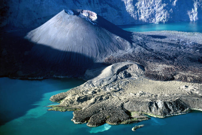
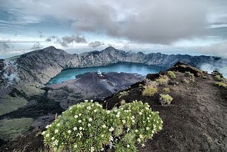
If the belt is the island of Java is finished, we will encounter panoramic views of the beautiful beaches such as Kute-Bali. Just look and compare the pictures of the beach here.
( Sights in Kute-Bali )

 ( Sunset , in Kute-Bali )


Here's a view of the beach is on the Cross Road South of Java island, namely: 
Picture Banyuwangi's Beach
                                          Description :

                                                            1. Pulau Merah Beach Banyuwangi
                                                            2. Lampon Beach Pesanggaran- Banyuwangi
                                                            3. Plengkung Beach
                                                            4. Grajagan Beach
There are beaches in the South Malang East Java, that its beauty like the Tanah Lot-Bali
Balekambang Beach-Malang
Ujung Genteng Beach


JLS as The Cross Street South of the island of Java at South Malang

I present the South Cross Road (JLS) located in the southern coast of Malang Regency. The information about JLS was obtained when I made a trip with colleagues to see off one of my friend moving to Sumbermanjingwetan Subregion Malang Regency.
Southern Cross Road East Java, Banyuwangi-Pacitan, where Malang Regency is a central axis along the ±140 km of total road length ± 650 KM of JLS. In 2011, the acceleration of the construction and completion is planned in 2013. JLS will connect Malang Regency to the East Banyuwangi/Bali and to the West Pacitan/Jogjakarta; both are the main beach of tourism in Indonesia.
JLS in South Coastal of Malang Regency is one of the three infrastructure to leverage economy of Malang Regency, while the other two are the construction of Pandaan-Malang Highway and Abdul Rahman Saleh Airport.

Optimization of the coastal area south of Malang Regency which is a strategic plan the government of Malang Regency led by Ibnu Rubianto (pbuh) has became people’s expectation in Malang Regency especially South Malang, because the southern coast of Malang Regency has beautiful and virgin beaches. The beaches with wave swash and mostly rugged shaped lot are abundant, among others if being traced from east to west for four districts only, there are Tamban and Sendag Biru beach in Sumbermanjingwetan district, Balekambang beach in Bantur district, Kondang Iwak beach, Mbanthol beach, Ngliyep beach and Jonggring Saloko beach in Donomulyo district. Not to mention the eastern beach which is located in Dampit and Tirtoyudo district.
JLS in south coast of Malang Regency is flashed on the shoreline of south beach which is predicted to invite the growth of tourism in South Malang such as accommodation and other tourism facilities is also expected to foster economy sector such as fisheries, farming and trade in South Malang region. As a proof of the hope, on the North coast of Bajul Mati there’s shrimp pond large enough with land on lease from the local people, said Drs. Mujiar, principal of Dharma Wirawan Malang High School.
Once JLS in Malang Regency is completed you can trace over started from Jogjakarta toward Bali and stop by in South Malang by pampering the eyes to see the coastal scenery as well as blended in TPI (Fish Auction Place) in Sendang Biru beach. You can eliminate the fatigue of the trip by stopping by in South Malang beaches playing around on the white sand beach as well as listening to the crashing and rumbling waves of the southern sea.
According to the Bina Marga strategic plan Malang Regency, JLS is a central program, whereas Malang Regency will completed JLS flipper in the late of 2011.

Cucak Rowo Bird

GENERAL
Bird cucakrowo or cucakrawa is one of the members of the friarbird. Vented or also called cucak-cucakan (java-language) (family Pycnonotidae) are a tribe of passerine from Africa and tropical Asia. These birds have the most mellifluous voices and chants are varied, often being a fuss by forest mainly her voice in the morning and afternoon. In the United Kingdom, the birds is known as the Bulbuls.

The original merbah in Malay refers to several types of passerine furry bleak in scrub, including species of birds-deer, tepus, bentet and others. Here, for the sake of standardization of terminology as used LIPI, the photograph used is limited to calling the birds of the family Pycnonotidae. Also called the Brown Shrike, the birds of the family has several other general term like friarbird (Java); tempuruk, empuruk; tempulu ', empulu ', pampulu, empuloh (various Malay in Sumatra and Kalimantan); and others.

Medium-sized, these birds are usually somewhat sleek-bodied, short neck, and tail is rather long. Often subtle bermisai.

Some species have bright colours: yellow, Orange, red, on the chest, abdomen or around his body. However most shadowy olive brown, greyish or yellowish, with yellow, orange or red in his ass. Male and female are similar.

Some with black on the head, the crest that can be digerak-move, or a white beard.

Brown Shrike is primarily a bird-eating fruit and insects. In the forest, most birds love to roam the grasslands and open woodlands half, picking fruit from a large small and hunt insects. Although some prefer to stay on top of the trees.
Often found in pairs or in groups, these birds are sometimes mixed with other types. Many voiced loud calling each other.

Brown Shrike nest in trees or shrubs, in the form of a cup of grass, leaves, stalks or incised leaves, mixed with other fibers. Egg 2-3 rounds.

VARIOUS TYPES OF VENTED

In Indonesia there are 27 species, primarily concentrated its spread in the western part of Indonesia. Only two species are spread far to South Sulawesi, one of which is also available in Lombok. However the two allegedly spread because brought humankind (feral, the later spin-off birds breed).

But strangely enough there was one of the members of this tribe spread limited (endemic) on the Islands around Sulawesi and Maluku, Brinji gold (Alophoixus affinis (Hypsipetes)). Even as living in the area of islands that are isolated from each other over millions of years, this species has evolved into nine different subspecies.
Some examples of this in addition to the tribe members vented cucak rowo (Pycnonotus zeylanicus) is a bulbul (p. melanicterus), Friarbird-headed bulbul (p. aurigaster), Orange-spotted bulbul (p. bimaculatus), yellow-vented bulbul (p. goiavier), olive-winged bulbul (p. plumosus) and Empuloh beard (Alophoixus bres).

Common bulbul is known as cucakrawa, cangkurawah (Sundanese), and barau-barau (Malay). In the United Kingdom called the Straw-headed Bulbul, referring to the colour of the head are a pale straw-yellow. The scientific name is Pycnonotus zeylanicus (Gmelin, 1789).

Medium-sized birds, the total body length (measured from tip of beak to tip of tail) of about 28 cm has a Crown (the top of the head) and an orange-colored earplugs or pale straw-yellow; continuous strip on the side of the Chin and the bridle lines across the eyes is black. Olive-brown dorsal bercoret-white streak, wings and tail are greenish or olive-brownish green. The Chin and the throat is white or whitish; the neck and chest grey-white bercoret; Grey, abdomen and buttocks are yellow. Iris reddish-colored, Black beak and feet are dark brown, ...


CUCAKROWO HABITAT
As the name suggests, the straw-headed bulbul is commonly found in swamps and marshes and swamps around the River, or on the edge of the forest. Often hiding behind foliage and only heard his voice.

The sound is heavier and harder than generally cucak and vented. Clear, clear whistles, raw rhythmic melodious. Often times sounding bersahut-sahutan.

In nature, these birds feed on insects, snails, and various fruits are soft fruit such as figs types.

In the lowlands and hills in the Malay Peninsula, Sumatra (includes Nias), Borneo, and the western part of Java. In Indonesia there are up to an altitude of 800 m above sea level, but is now already very rare due to poaching.

It is one of the very popular as a pet bird, due to the melodious booms. In Java, it's been very much dwindled the population due to hunting scene since the early ' 80s.

The birds listed in Java with most imported from Sumatra and Borneo. Now in many parts of the island of Sumatra (for instance in Jambi, along the stems of Bungo) one population continue to be ebbing. Collar et al. (MacKinnon et al., 1994, in 2000) classifies population bulbul into vulnerable status. Similarly the IUCN stated that this bird is Vulnerable (VU, Vulnerable). Descriptions of the conservation status of the more detailed can be seen on the IUCN site below.

If there is no better rescue measures from now on, perhaps some years into the future these birds just lived memories; living mentioned in song as in the Villages Cucakrowo in Java.

HALLMARK BASED ON ORIGIN REGION
In general there is no difference in the volume of voice types, attitudes and based by region of origin/habitation. Cucakrowo Sumatra and Kalimantan have good minded individuals, there is a volume of great thin-voiced, some were and some were voiced ropel. Physically, the relative areas of Sumatra cucakrowo is larger than the other islands. However, in general body cucakrowo in Borneo who entered Malaysia region, such as bongsor-bodied cucakrowo Sumatra.

CAPTIVE
Captive Cucak rowo BIRD was in Tumpang  Malang in East Java province. This area is the area in the East Malang lies about 11 KM from the city of Malang is one of the flagship regional tourism Government of Malang.

TIPS CHOOSE CUCAKROWO
There are some important things to note in the selection of materials or going on a bird cucakrowo.
  1. Body Posture. Choose a material with berpostur large elongated neck, body and long tail and legs are mismatched. Please choose the material closely, generally short and berpostur small body.
  2. Form of the beak, we recommend that you choose a half width of the shape, thick-stemmed, large and long. Bottom half should be straight. Don't choose materials that have crooked beaks. The position of the nostrils select as close as possible to the position of the eye.
  3. Wings and strong legs mencengkram meetings, this indicates that healthy ingredients. Color of the legs does not affect the attitudes of birds.
  4. Agile and lust for a great meal. This is the material characteristics of good minded individuals.
  5. This represents the sound, Diligent bird has bright prospects.
  6. Long neck solid contains. Indicates the bird would emit power voice to its full potential.
HOW TO CARE
  • Venue: Cucakrowo could be maintained with a square box with the size at length 45-60 cm high by 60-70 cm. whilst the perch or a perched bird can be made from the wood of an acid with a diameter of 1.5 cm.
  • Feed: same as other birds in General, the feed menu requires cucakrowo virtual so that the sufficiency of the nutrients, vitamins and mineralnya. Good feed, in addition to complete nutrisinya like protein, carbohydrates, as well as his complete such as vitamins A, D3, E, B1, B2, B3 (Nicotimanide), B6, B12, C and Hse. In addition, the need to also contain essential substances such as D-Methionine L-Lysine HCl, I, Folic Acid (is in fact a form of vitamin B) and Ca-D
 In addition to vitamins, it is necessary also the adequacy of minerals. The minerals required in the formation of bone, blood and body fluid balance, nerve function in healthy, heart blood vessel system function and others. Like vitamins, minerals to function as a ko-enzyme, allowing the body to perform its functions such as producing energy, growth and healing.
That includes the required mineral cucakrowo bird is Calcium, Phosphor, Iron, Iodium Manganase, Cuprum, Zinccum, Magnesium, Sodium, and Potassium Chlorin.

I LOVE MY COUNTRY WITH ALL ANIMAL

Barong -Rangda Dance (Balinese Dance)

This dance is the cultural heritage of Hinduism who uses puppets Pre intangible quadruped or ancient humans that have magical powers.

Barong mask made from wood taken from the austere places such as graves, therefore sacred objects is a Statue was sanctified by the Hindu community in Bali. These dance performances with or without play, always beginning with the show opener, which was accompanied by the gamelan. There are several types of dance frequently intermediat yet staged for the consumption of tourism that is the kind of Baring Ket. Barong and Rangda Sakralisasi, the point is:

Not every tangible objects such as the Barong and Rangda may be called Barong and Rangda. It is related to whether or not there is sakralisasi process through the ceremony. If this string does not exist, can just Barong and Rangda called "barong-barongan" and "rangda-rangdaan" (barong and rangda imitation). This is important because the sakralisasi process of embodiment of the Barong and Rangda will show the value of magisnya so that people feel closer spiritually.

Although the mask along with the jewelry/accessories have been installed, will not be able to have a magical power before getting the ceremony Utpeti (sanctification). This sanctification process is conducted in several levels, namely:
  1. Levels of Prayascita and Mlaspas.
  2. Levels of Ngatep and Pasupati.
  3. Levels of Masuci and Ngerehin.
Barong dance is the third series of the ceremony baliDengan the barong and rangda may be said to have been sacred, sacred, containing the value of the beraspek relegius as well as majis entitled Mantilla as aspects of God's power and become religious objects in steadying the value sense of filial piety.

Before the third level of the above ceremony was held, the first carried out several activities, namely:
  1. Specifies the days both manufacture Barong and Rangda so the becomes very sacred items is determined by the determination of a good day.
  2. Determine the type of wood that will be used for the manufacture of masks Barong and Rangda. Commonly used wood is wood that is believed to have magical powers.
  3. Awarding of colours. Awarding of colours on a mask Barong and Rangda is a thing that is important because with a good color match and will give the impression of living as well as authoritative as well as the great.
  4. Barong and Rangda outlined.
  5. Installation of feathers and other accessories.

Barong ket dance or called Barong Keket dance Keket is most widely found in Bali and most often performed as well as having a complete motion dance pebendaharaan. From there, the Barong Ket is a cross between a lion, Tiger, cow or boma. The Barong is decorated with carvings made from leather, affixed a glittering mirror glass and feathers are made of perasok (a kind of plant fibers from the leaves of pandan-like), roofed there anyway from feather crows.

To dancing this Barong carried on by two dancers called Interpreters Saluk /Interpreter Bapang, a dancer at the head and the other on the rump and tail. Barong dance was painted about fight Keket endless between virtue (dharma) and evil (adharma) which is a combination that always opposite

(Domestic and overseas tourists watch Barong dance)
Barong is composed of two types, namely Barong for religious ceremonies and Barong for the show. Barong for the ceremony are stored in Pure displayed only if there's any ceremonies. While the Barong for the show is usually in the presence of tourists instead of religious ceremony for the statue. Barong dance can be seen in Denpasar-Bali.

These dance performances with or without titles, always beginning with the show opener, which is accompanied by different Gamelan Gong Kebyar, Gamelan Batel, and Gamelan Babarongan .

The Barong types up to now still in Bali is as follows:
  1. Barong Ket
  2. Barong Batal (cancel)
  3. Barong Asu (dog)
  4. Barong Brutuk
  5. Barong Kedingkling
  6. Barong Gajah(elephan)
  7. Barong Macan(tiger)
  8. Barong Landung
  9. Barong Kambing(goat's)
  10. Barong Sai

The Beauty Of Indonesia

When I was still in high school, my teacher said that the nation of Japan was invited to exchange areas, I think why Japan has been advanced that wants to exchange the area with one of the areas in Indonesia. Indonesia was indeed beautiful, beautiful charming.


What makes me amazed to this my country? Among them are:

  • Indonesia has diverse cultures. For example, such as language, dress, customs, arts etc. all depends on their respective areas. with the various cultures in Indonesia, then it can deepen the culture of each other. "Bhineka tunggal Ika" which means vary but remain one. Yes that's INDONESIA
  • Indonesia Cuisine. Perhaps, had I was able to explore the world, I can't find the food very tasty world except in Indonesia. With a wealth of spices in Indonesia, then an awful lot of variety of dishes with a wide variety of seasonings Indonesia certainly tasty all. I can call it that Indonesia is a heaven for food in the world.
  • Natural Beauty. I'm amazed by the natural beauty of Indonesia. From the start to an impressive natural landscape and soil fertility in Indonesia. Yeah like this image:


(Image taken from the National Geograpics)
This image is one of the attractions and the natural landscape in Indonesia. Nice isn't it??
  • Indonesia is the world's largest muslim country. The number of adherents of the religion of Islam in Indonesia is about 216 million or 88% of the population of Indonesia. Indonesia also has the largest number of mosques and Hajj pilgrims home country in the world. It's no wonder if the traders in saudi Arabia are mostly speak Indonesia. In addition, for the Muslims who want to go or streets to Indonesia would be very easy to find the mosque or the mosque to worship.
  • Indonesia is the country with the largest areas of language, i.e., 583 languages. The national language is Indonesia language although local languages with the largest number of users in Indonesia's Java language.
  • Indonesia was ranked 1st in agricultural products, namely: cloves (cloves) & nutmeg (nutmeg), as well as pringkat to 2 in producing natural rubber (Natural Rubber) and crude palm oil (Crude Palm Oil).
  • Indonesia is the world's largest maritime Country with waters of 93 thousand km2 and has a long coastline of about 81 thousand km2 or almost 25% of the length of the beach in the world.

Every ride an airplane, and then view the current state of the skip over, then indeed there is nothing as beautiful as Indonesia. Starting from Aceh to Papua, large islands, small appeared green. Consists of mountains, paddy fields, verdant forests, everything looks wonderful.

Beauty is more evident again when viewed up close. When traveling by land vehicles, where, from one place to another, from one island to another island, it appears everywhere. In all the areas traversed there is always some trees, paddy fields, hills, mountains, and gardens, and beautiful plants.

Due to the trees or grow any tumb-uhan can be grown and living, then just about any fruit in Indonesia it is sometimes difficult to recognize the names. What are planted to grow and bear fruit. Different types of fish, sea fish, fish ponds and rivers, all exist everywhere. So are the different types of mines, such as oil, gas, coal, gold, diamond and others.
There is indeed only the parts of the damaged environment, such as forests in Java, Borneo, Sumatra, Sulawesi, and even also in Papua. These forests are damaged by human behavior. As a result, many rivers that water is narrowing and even dry. The trees are cut down, which was originally to shady areas that become bald. But actually still berpontensi for planting back.

Beautiful picture like it's not going to come by in other countries, especially in many parts of the berpadang sand. If we're flying over Egypt, Sudan, Saudi Arabia, Iran, Iraq, Yemen, then brownish color look is. The area is either desert broad. In the Sudan or Egypt, if seen from the air there are parts of the verdant-looking, but only limited around the area impassable to the Nile. A bit far from the river the land is barren area as cue pinkish and barren.

Desert area, in addition to the barren, too hot. Can't imagine how hard the farmers or ranchers to develop his business. If you ever come across an area in Riyad, named Ashofi. The desert was contrived as a center of dairy farms. To merely raising water cattle, they first have to change the desert into a garden in the tropics. Beriku-thousands of hectares of the area is Rocky and sand are depicted in waterways and planted trees and grass.

Furthermore, where it was made of cow cages, at each location approximately 40 000 tail, and because of the hot air, then the enclosure must be equipped with air conditioning. Cages must be cow, so that the cattle were AC can live and thrive. Can't imagine how much extra cost that must be removed if compared raising water in Indonesia. Imagine how hard it is raising water in the desert area make easy to enjoy the natural beauty of the country.

Indeed the beauty of this homeland, presumably not easily perceived and even enjoyed for people who rarely go to arid countries and especially those of the desert. Late last year, I had the opportunity to travel to Russia. Incidentally there was winter, temperatures of about minus 15 degrees. Everywhere there is snow and of course a very torturing, especially for me who have never been to the area to cool like that. Again, when encountered such circumstances, reminding how good and beautiful Archipelago.

The beauty of Indonesia recognized by a probe of the country.
The beauty of Indonesia, is often expressed by many people who come from overseas. No exception lecturers coming from Sudan, Saudi Arabia, Egypt, and Australia, who taught several years at UIN Maliki Malang. When the first people of Sudan and Egypt to the top of Batu City Malang East Java at night. Once in place they were shocked, amazed and commented, if this is the paradise promised by God. The beauty Batu at the time of the night, for they are very admirable. During this time, they have never seen such a beautiful place, as stone town at night.

Whereas, Batu city  is not only a beautiful place in the country. There are many other places that are not less beautiful. Only unfortunately indeed the beauty of it, in some places has been reduced, due to its human behavior. This is a very beautiful country, which should be settled by people who are thankful and optimistic. Not vice versa, always complaining and feeling of inferiority.

Still a lot of beauty and an excess of Indonesia. I think indonesia has indeed beautiful. and how about you?? :)